Mamba-UNet++ for Landslide Susceptibility Mapping Driven by Terrain and Rainfall Raster Data
DOI:
https://doi.org/10.64972/dea.2023.v2i3.3682d:14-26Keywords:
Landslide Susceptibility Mapping, Terrain Raster Data, Mamba State Space Model, UNet++Abstract
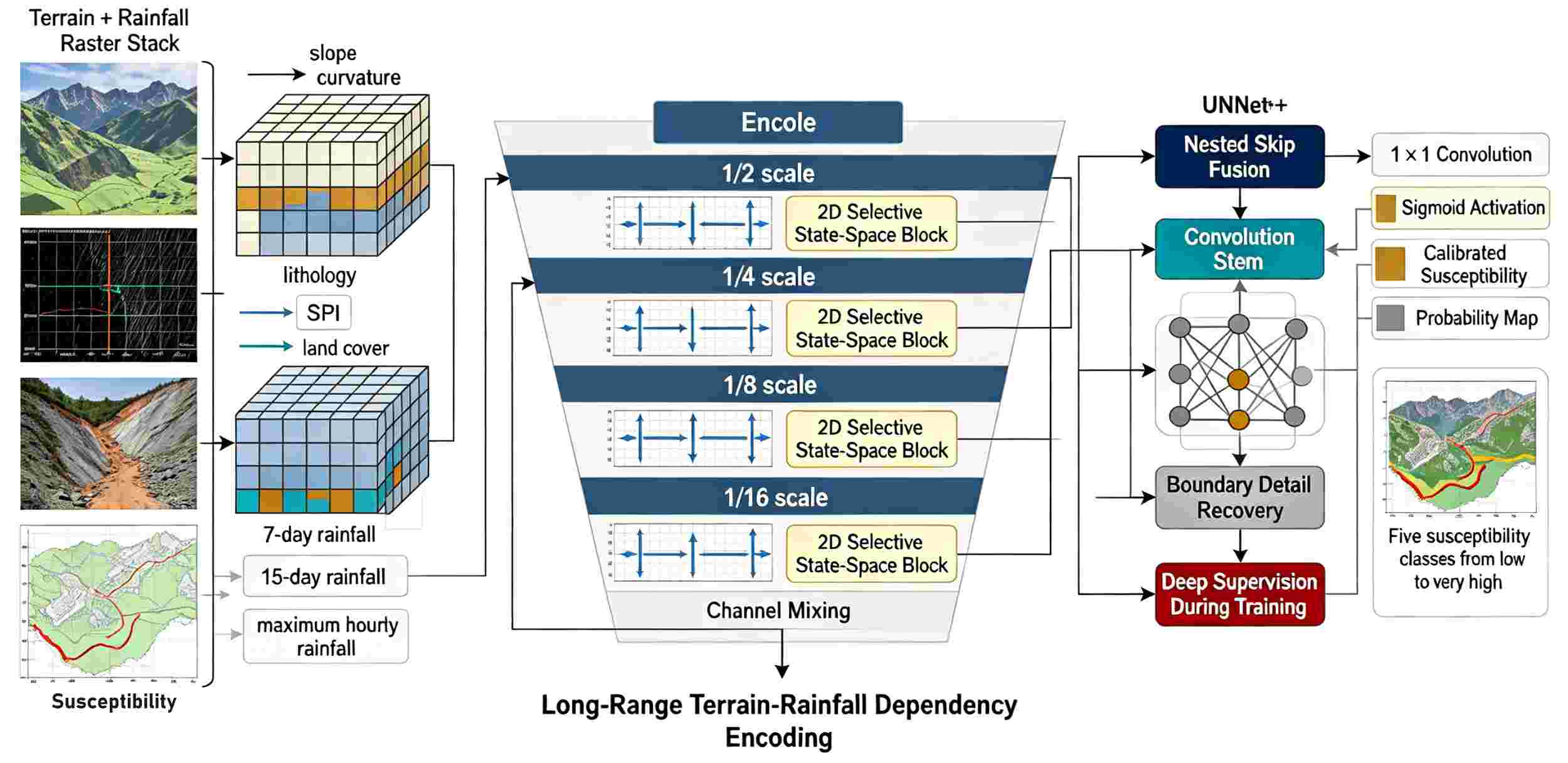
Landslide susceptibility mapping requires a model that can preserve local terrain discontinuities and learn rainfall-triggered spatial dependencies in catchment-scale raster grids. Using 10 m terrain-rainfall raster inputs, this study evaluates Mamba-UNet++ for susceptibility zoning rather than for pixel classification alone. Mamba-UNet++ is a raster segmentation framework proposed in this paper that integrates a selective state-space encoder with a nested UNet++ decoder for terrain and rainfall-driven susceptibility mapping. The input stack includes elevation-derived slope, aspect, curvature, topographic wetness index, stream-power index, distance to drainage, lithology code, land-cover code, antecedent rainfall and maximum hourly rainfall. A 10 m grid inventory from a mountainous study region was divided into 18,240 training patches, 3,920 validation patches and 4,105 test patches. Mamba-UNet++ achieved an AUC of 0.934, an F1-score of 0.812, a balanced accuracy of 0.879 and an expected calibration error of 0.047, outperforming UNet, UNet++, DeepLabv3+, and Swin-UNet by 2.1-6.8 percentage points in AUC. The results indicate that the model improves both susceptibility ranking and probability calibration for engineering-oriented raster zoning.
Downloads
Published
How to Cite
Issue
Section
License
Copyright (c) 2023 Gustaw Chmiel, Waldemar Gut, Juliusz Grabiec

This work is licensed under a Creative Commons Attribution-NonCommercial-ShareAlike 4.0 International License.